





AFTrack-Lite - GPS Tracking

AFTrack-Lite - GPS Tracking의 설명
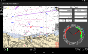
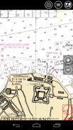
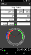
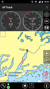
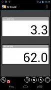
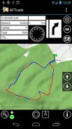
AFTrack is the display for your GPS. It activates the world of hiking, biking, sailing, geocaching and more to your phone. The program handles tracking with smart and fixed logging features. It sends reports via GPRS or SMS. It receives SMS position messages and show it as a waypoint. It exports tracks and waypoints. Uses maps online and offline and more.
Features
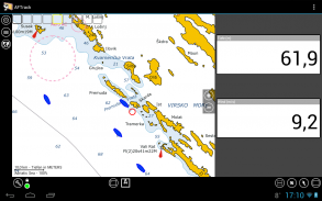
- map view with info docks - track, profile, route, way point. gps info
- different gps modes: internal gps, internal with NMEA, bluetooth gps direct, gpsd, NMEA file
- collecting track data
- show routes or tracks in up/down hill colors
- export tracks to GPX, KML, IGC, OVL format
- import route data - GPX, TCX or KML format
- import, export way points - GPX or KML format
- import areas from KML format
- off road routing along the line
- online maps - pool editable
- offline maps - OSZ format build by MobileAtlasCreator (http://mobac.sourceforge.net/)
- offline maps - SQLite formats mbtiles and sqlitedb build by MobileAtlasCreator
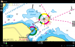
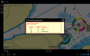
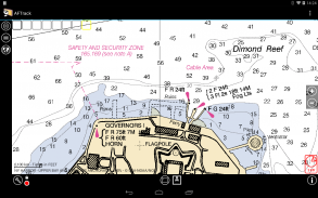
- offline maps - BSB3 format for marine navigation (needs Android 2.2 or higher)
- offline maps - mapsforge vector file format (needs Android 2.2 or higher) - experimental
- use offline maps from jpg, png or bmp files
- use offline maps with calibration file map, gmi, kml, kal, cal, pwm or jpr format
- seamless maps display when using OSZ or SQLite tile container
- map selector to have quick access to available offline maps
- map scan for a defined folder and sub folder
- map overlays - pool editable
- virtual map center on multi tracking or waypoint and position
- wind indicator for the map center
- display depth - if available
- copy way points to route
- revers routes
- altitude correction (automatic or manual)
- pressure usable for altitude (if available)
- NMEA logging with filter
- GPRS position sending for live tracking
- short message position sending
- short message position receiving
- short message from GPS tracker TK102, TK102-2, TK102 clones, DNT, ELRO, GEODOG or SmartcomGps
- text storage for short messages e.g. for Xexun tracker
- collecting short messages to a track - single or multi tracking
- getting way point positions from a GpsGate server
- set anchor alarm for the current position
- set anchor alarm for a way point that receives positions from a gps tracker
- save and restore settings
Minimum Android version: 2.1, runnable on version: 4.0
Minimum screen: 320 x 480
Android Market and/or Google account: -
Third-party libraries: -
Rooted device: -
Please send remarks toafischer@dbserv.deKeywords: gps, gpsd, bluetooth, tracking, tracker, pet tracker, POI, way point, hiking, biking, sailing, maps, Google maps, OpenStreetMap, OpenSeaMap, osm, bing maps, offline maps, GPX, KML, offline, offroadAFTrack은 GPS에 대한 표시입니다. 그것은 하이킹, 자전거 타기, 세일링, 지오 캐싱 및 휴대 전화에 더의 세계를 활성화합니다. 이 프로그램은 스마트하고 고정 로깅 기능을 추적 처리합니다. 그것은 GPRS 또는 SMS를 통해 보고서를 보냅니다. 그것은 SMS 위치 메시지를 수신하고 웨이 포인트로 보여줍니다. 그것은 트랙과 웨이 포인트를 보냅니다. 온라인과 오프라인지도를 더 사용합니다.
특징
- 정보 도크지도보기 - 트랙, 프로필, 경로, 웨이 포인트. GPS 정보
- 다른 GPS 모드 : 내부 GPS, NMEA, 블루투스 GPS 직접 GPSD, NMEA 파일로 내부
- 추적 데이터를 수집
- 업 / 다운 힐 색상 쇼 경로 또는 트랙
- KML, IGC, OVL 형식 GPX로 트랙을 내보낼 수
- 수입 경로 데이터 - GPX, TCX 또는 KML 형식
- 수입, 수출 방식 포인트 - GPX 또는 KML 형식
- KML 형식으로 가져 오기 영역
- 선을 따라 라우팅 오프로드
- 온라인지도 - 풀 편집
- 오프라인지도 - OSZ 형식 MobileAtlasCreator (http://mobac.sourceforge.net/)에의해 구축
- 오프라인지도 - MobileAtlasCreator하여 SQLite는 형식 mbtiles 및 sqlitedb 빌드
- 오프라인지도 - 해양 탐색을위한 BSB3 형식 (안드로이드 2.2 이상이 필요합니다)
- 오프라인지도 - mapsforge 벡터 파일 형식 (안드로이드 2.2 이상이 필요) - 실험
- JPG, PNG 또는 BMP 파일에서 오프라인지도를 사용
- 교정 파일지도, GMI, KML, 칼, 칼, PWM 또는 JPR 형식과 오프라인 맵을 사용
- OSZ 또는 SQLite는 타일 컨테이너를 사용하는 경우 원활한지도가 표시
- 오프라인에서 사용할지도에 빠르게 액세스 할 수있는지도 선택
- 정의 폴더와 하위 폴더를 보려면지도 검색
-지도 오버레이 - 풀 편집
- 다중 추적이나 웨이 포인트와 위치에 가상지도 센터
-지도 센터를위한 바람 지표
- 깊이를 표시 - 가능한 경우
- 경로에 복사 방법은 점
- 가역적 노선
- 고도 보정 (자동 또는 수동)
- 고도에 대한 압력의 가용 용량 (사용 가능한 경우)
- 필터 NMEA 로그
- GPRS 위치는 라이브 추적에 보내기
- 보내는 짧은 메시지 위치
- 수신 짧은 메시지 위치
- GPS 추적자 TK102, TK102-2 TK102 복제, DNT, ELRO, GEODOG 또는 SmartcomGps에서 짧은 메시지
- 단문 메시지 예 : 텍스트에 저장 Xexun 추적자
- 트랙에 짧은 메시지를 수집 - 단일 또는 다중 추적
- GpsGate 서버에서 웨이 포인트 위치를 얻기
- 현재 위치에 대한 설정 앵커 경보
- gps 추적자의 위치를 수신하는 방법 점 세트 앵커 경보
- 설정을 저장하고 복원
최소 안드로이드 버전 : 2.1 버전에서 실행 가능 : 4.0
최소 화면 : 320 x 480
안드로이드 마켓 및 / 또는 Google 계정 : -
타사 라이브러리 : -
뿌리 장치 : -
비고란에afischer@dbserv.de을 보내주세요
키워드 : GPS, GPSD, 블루투스, 추적, 추적자, 애완 동물 추적자, POI, 길 점, 하이킹, 자전거 타기, 항해,지도, 오프라인 구글지도, OpenStreetMap, OpenSeaMap, OSM, 빙지도, 오프라인지도, GPX, KML, 오프로드


